Bandon, Oregon

 ORMI 99 (Oregon Mile 99). Photo by Ross Todd.
ORMI 99 (Oregon Mile 99). Photo by Ross Todd.

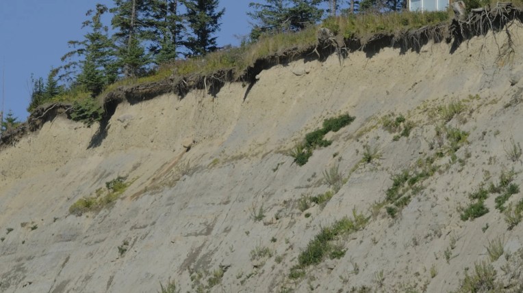
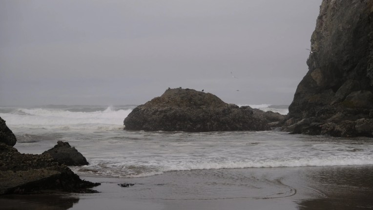
With the Pacific Northwest being one of the most geologically active regions in the world, the Coast Range of Oregon is cut dramatically making it a site of breathtaking seascapes. The Bandon area of southern Oregon is dotted with a number of popular beaches that draw in tourists such as the circles in the sand beach and face rock point as well as lesser known spots or private beaches.

As with much of the pacific coast, the gold rush era introduced change in the social and cultural makeup of the area. Prior to 1850, the Bandon area was inhabited by the Coquille Indians. These people, along with many coastal native peoples, were removed from their lands and relocated to the coastal reservation at Siletz. The Oregon History Project has documented some themes around the interplay between natural history and human actions, namely, the isolation from physiographic aspects, the strong presence of federal policies which shaped transportation, demographics, and industrial development, and the inequities in Indian-white relations. One tension that they highlight, which is particularly salient in a period of rapid climate change, is the isolated nature of the region with the economic dependence on the outside world.

Bandon is in Coos County, which makes up only 1.5% of the entire state population. The town’s name comes from a town in Ireland of the same name. Prior to being named Bandon, it was called Averille. It was incorporated in 1891 after being designated an important shipping port.

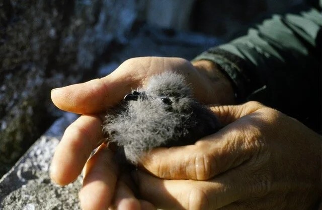
During the visit, we spoke with COASST surveyors at the Bandon beach site as well as a surveyor who covers Whiskey Run, Cut Creek South, and Sacchi Beach. COASST volunteers, Diane and Dave Bilderback, conduct regular surveys on their beach for expired birds to track the health of bird colonies just offshore. The dynamic nature of the beach and the daily changes that result from such a diverse ecosystem provide an air of excitement and anticipation for these citizen scientists, as heard in Diane’s voice.   

Participating in monthly COASST surveys has been one way through which the Bilderbacks have developed a fondness for the place now called Bandon, but also a fondness for the community of people who monitor beaches up and down the pacific coast. Diane and Dave recall how they first got involved in the COASST program, which started with Diane’s mother who expressed initial excitement for the work.

What began as an opportunity to connect with family and community has enhanced a passion for the natural environment, providing Dave an outlet to expand and explore, viscerally, the coastal geomorphology and cyclical nature of change at Bandon.  

With each annual season, coastal change occurs rapidly at Bandon, part of a long history of a landscape that has seen remarkable change in physical form, purpose, and occupancy over time.  

Nehalem Beach, Oregon

 Gulls taking flight at Nehalem Beach. Photo by Ross Todd.
Gulls taking flight at Nehalem Beach. Photo by Ross Todd.

When I get to Nehalem Beach, BB meets up with me to do the survey together. In the clip below, he speaks about everyday connections and the temporality of a place.

 Bryant Bainbridge (BB) (left) and Sarah Inman (right) after we walked a survey on Nehalem Beach. Photo by Ross Todd.
Bryant Bainbridge (BB) (left) and Sarah Inman (right) after we walked a survey on Nehalem Beach. Photo by Ross Todd.
 In the clip above, BB talks about different bird personalities and mentions this photos of the Ashy Storm Petrel
In the clip above, BB talks about different bird personalities and mentions this photos of the Ashy Storm Petrel

Lands End & Harbor Mouth, Alaska

 Kittiwake nesting at Harbor Mouth, Homer Alaska. Photo by Ross Todd.
Kittiwake nesting at Harbor Mouth, Homer Alaska. Photo by Ross Todd.

Lands End and Harbor Mouth are side by side and comprise the tip of the Homer Spit. Granted it is summer when we visit, but this is a busy spot. Ferries shuttle people across Kachemak Bay; people fish in the surf; tourists are taking photos of sea otters. This is also a crowded spot for birds with hundreds of gulls flying overhead.

Carol spends time with me to show me how she does her survey and talk about some of her experiences doing natural science surveys.

 Carol Harding at Lands End Beach
Carol Harding at Lands End Beach

Throughout our walk, Carol tells me about some of the changes that have occurred on her beach. In the short clip below, she compares the sea star sightings of the past to the present.

Bishop’s Beach, Alaska

 Photo by Ross Todd.
Photo by Ross Todd.

Bishop’s Beach is a popular beach amongst locals in Homer and certainly represents one of the most diverse beaches in terms of its usage. During our visit, we see Fish and Wildlife Service biologists banding ducks to understand their migration; we talk with birders who love to watch waterfowl near Beluga Slough; we see tire tracks and learn that driving is allowed on parts of the beach and that people harvest coal, often found in the wrack line. These coal seams exist because the ocean wears down upper layers of peat exposing seams of coal during low tides. The level of salt content in the coal makes it an inefficient source of heat; however, people can collect this for free.

Paul Allan and Louise Ashmun share their experience walking this beach. They returned to Homer about decade ago and love being a part of the scientific observing community. Paul excitedly talks to me about some of the dramatic changes he sees with respect to the sand on the beach.

Paul and Louise talk about the ecological dynamics that makes Bishop’s Beach unique.

Paul and Louise talk about the dynamics that make their beach less of a hot spot for dead birds, but Louise notes that this isn’t the case for trash. “We get lots of trash!”

Louise and Paul marvel at what gets left on the beach and how quickly it gets consumed by nature.